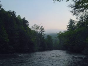
 I get asked a lot what are some of my favorite kayak spots near Atlanta. Without a doubt, Dawson Forest Wildlife Management Area is the first to come to mind. It is not often you can paddle through a place that was once the site of a secret underground military base with the Air Force and Lockheed. Literally, hundreds of people worked in an underground lab in this area of Dawson Forest Wildlife Management.
It has a story and it also is one of the most scenic recreational paddles you can find. And for most of the Atlanta area, its under one hour drive away. Dawson Forest (which is in southern Dawsonville) is owned by the city of Atlanta and is fast becoming the new must-see if you crave some outdoor adventure and fun.
Dawsonville has a great history. In the 1930’s Dawson County’s fastest moonshine runners would gather on a Sunday afternoon. They’d place bets on the fastest cars. This location where our kayak trip begins is somewhere very close to where these moonshiners raced. Three of these men became NASCAR legends and one an early founder. How about that history!
The Etowah River flows here. The great thing about this river…its clean. Its also very diverse biologically, with more species of fish than nearly any in the United States! It fact, there are 75 species of fish in this river. Two of these species…Cherokee and Etowah Darters are found nowhere else in the world.
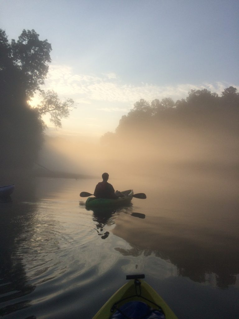
That makes this river perfect for a day kayak trip and time away from the hustle and bustle of city. I always strive to give my customers the best outing and experience. This is why this year 2020, we’ll be spending a lot of time up on this section of the river.
It is well suited for nearly all skill levels of kayakers. The water flows at a good speed, so you aren’t over-exerting yourself. But it is 9 miles of twisting and turning through some tight spots at times. Each river bend is like a slide show, a new snapshot of scenery around every bend. There is plenty to see here and it is never dull.
Even though we aren’t far from civilization, there really are no houses along this route and not many people. It makes it a hidden gem. So this scenic and fun paddle is now available for anyone willing. I will be running trips (guided and unguided) up here 2 or 3 times per week. In order to get up-to-date information and trip updates, sign up for my newsletter. It is free and I will never give away your email to anyone. This allows me to update folks on river conditions and weather updates. Plus, I am trying to keep this location a bit private so it doesn’t get overrun with people. So when you sign up, you’ll receive location, details, and any trip information.
We will be running trips both in the morning and in the afternoon. The morning is best for seeing wildlife and is a bit cooler in the summer heat. The afternoon is great if you want to try some swimming and rope swinging. The Etowah River is normally fairly warm and provides good relief in the sweltering Georgia summers. Oh and along the route about 6 miles into the trip there is a perfect place to stop for lunch and hang out near a remote waterfall. It is only accessible by hiking a long distance or paddling to it. It makes for a great stopping and resting point and to have a snack. There is a rope-swing here and another just down the river a bit. In the summer this is a place we spend a lot of time.
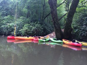
This photo to the left is the first rope swing. It is also just a short walk to the waterfall that you see in the picture below. There is a horseback riding trail here, so there is a good chance you’ll see the horses drinking from this small river.
The waterfall is actually two levels and one steeper than the other, so its a good idea to have a good water shoe or closed sandal to avoid slipping. This spot is a great for taking pictures. Many people like to hike up the waterfall but hike back down the trail that runs next to it. This is the safest way to approach it.
Always be sure to have a zip lock bag or a waterproof bag to secure your phone and valuables. This trip isn’t one where you will stay dry. So bring a spare set of clothes. There is a nice clean changing room at the end of the journey. You’ll have a chance to get out of wet clothes. The super family that owns this parking lot at the end the trip allows us to park here. In return we promise to keep it clean. They run a small campground and boat ramp. They are some of the nicest people around.
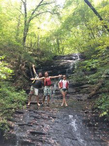
This photo is the lower part of the waterfall. It is a bit flatter, so it makes it easier to climb this section. The upper portion can be climbed but is more inclined and dangerous. The waterfall is called Bearfoot falls. I’ve never seen any bears here, but I have seen some horses. There is a platform here and a primitive campsite which makes for a good rest spot. So bring a lunch, some snacks, and your favorite beverage.
After you leave the waterfall and paddle downstream, there are some amazing scenic spots. A small shoal (called Radioactive Rapids) provides a great place for some entertainment. It is marked by an island that splits the current equally. It love it because I let paddlers choose their fate. Go right and navigate your way through tree overhang and swift water. Or go left and shoot through the largest rapids on the journey. Both are fun and makes for a great place to take pictures.
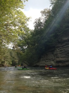
Two miles downstream of the shoals is an impressive rock bluff on the river right. It has some geological significance. As the Etowah River flows from the mountains it cuts through three geological areas…Eastern Blue Ridge, Western Blue Ridge, and Ridge and Valley. It is at this rock bluff where you will see the convergence of these geological areas. It is pretty awesome… even if you aren’t a geologist and history buff.
Nearing the end of the journey, there is a rock island planted in the middle of the river. This rock is another of our stopping points. We’ve taken a lot of action shots here and coordinated many mid air photos. The eddy that swirls behind this rock makes it a perfect place to jump into the current, then get pulled back behind the rock and do it all over again. The water here is deeper than you think. It’s 7-8 feet deep so enough for feet first, but no diving please.
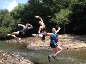
This picture shows just how fun “rock island” can be. The massive eddie swirls below this rock and makes it the perfect swimming hole. We have taken many action photos and has become a contest to see who can create the best photo. I still think this is one of the best.
This is also a great spot for a camping and kayaking 2 day trip. So again, if you’d like to take part in any of these trips or interested in more details….sign up for the Kayak Guy Atlanta newsletter and I will be sending trip reminders and details to your inbox. You can also see us on Facebook and Instagram. I can’t wait to see you on the river and enjoy some adventure with my fellow kayakers. I will also be hosting plenty of other river trips. They will differ in degrees of difficulty. Sign up here to get future trip reminders. See you on the river!
-Scott
So that is why I love the Etowah River and especially this section of the river. I hope to see some new faces out on this trip. If at any time you would like to enjoy this route….please let me know. (678 920 3944) or email (Scott@KayakGuyAtlanta.com) Just mention the Etowah River at Dawson Forest. I love introducing new people to this river. You won’t be disappointed!


2 Responses to Etowah River – Dawson Forest (9 miles)